SurCheck
Check Twice, Deliver Once
Surdex’s commitment to continuous improvement and unrivaled efficiency firmly establishes us as a leader among geospatial data providers. Our commitment to delivering a premium quality product is reflected in the fact that 98% of our data is accepted by clients on delivery.
To give our clients the ability to quickly and efficiently inspect and validate their imagery, Surdex developed a web-based tool called SurCheckSM. This easy-to-use, intuitive interface enables users to:
- Inspect data
- Identify areas requiring remediation
- Validate that corrections have been made
Many of our clients on even large projects conclude that our internal QC is so robust, they may have only a handful of corrections
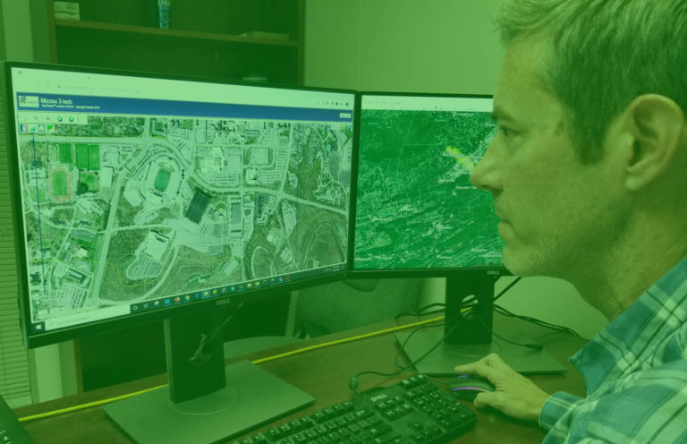
Watch the video for a full overview of SurCheck
SurCheck streamlines the inspection, remedial action, and delivery timelines. As call-outs are reported by reviewers, Surdex resolves each and notifies reviewers so they may confirm the correction. Since Surdex works off call-outs in parallel with the inspection process, it is common for reviewers to receive corrections within 1-2 weeks. When all call-outs are resolved for the project the data can be shipped on hard drives for final delivery. In many cases, clients choose to have orthoimagery added to SurCheck incrementally, further expediting inspection and allowing leveling of inspection resources.
Download and read more about our SurCheck online inspection tool.
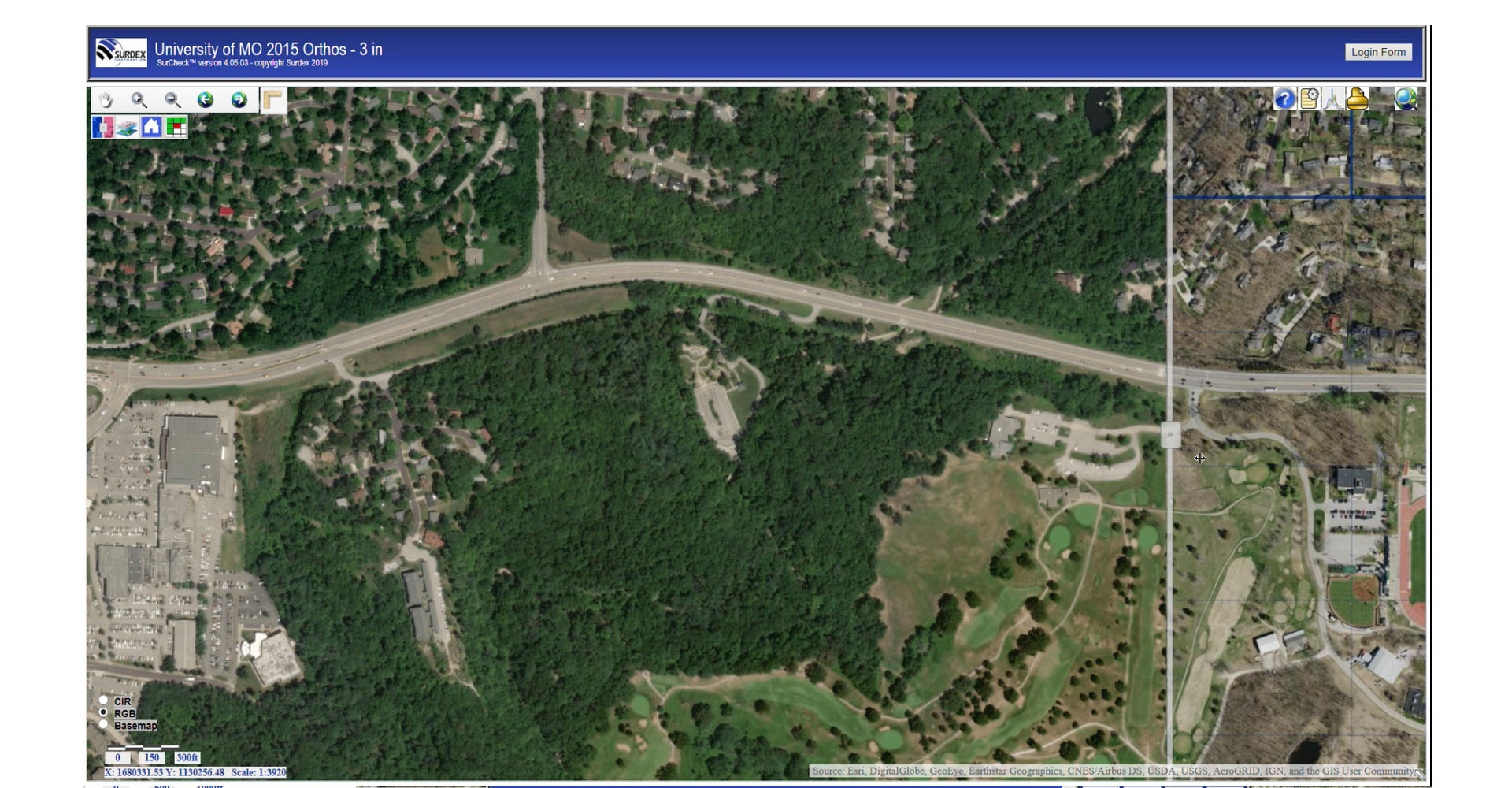
The following screens illustrate the basic functionality of SurCheck.
Multiple Work Cells
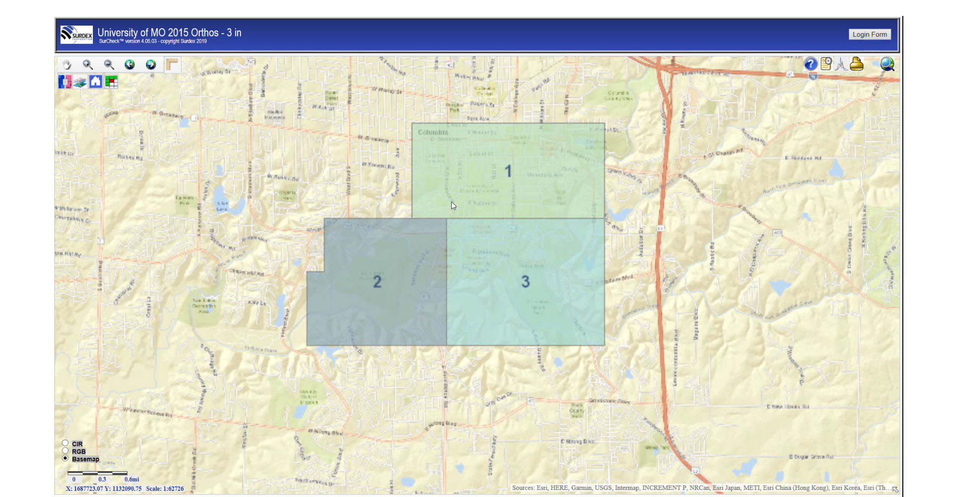
SurCheck divides your project into multiple work cells for different inspectors. In this example, the project has been divided into three work cells, which you can zoom into a work cell to see a granular tile grid, called the progressive inspection grid.
Progressive Inspection Grid
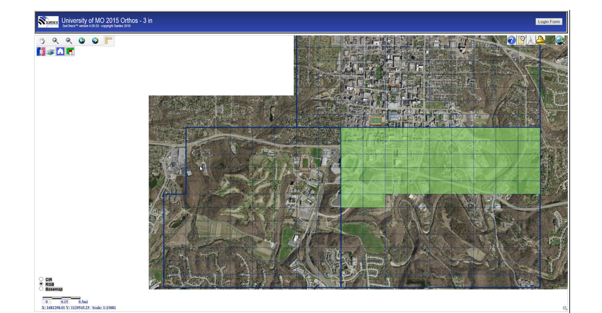
In the progressive inspection grid, an inspector can toggle the background between the base map, RBG imagery or the color IR, if available. Also, an inspector has the ability to zoom into the grid and manipulate the layer controls or use the swipe tool to compare imagery from the previous project year.
Measurement
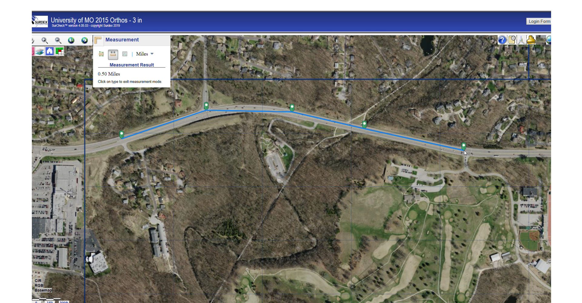
SurCheck also enables an inspector to take measurements with the measurement tool. For example, measuring the mileage of a roadway. Each inspector has their own unique user ID and password, where different inspectors can be assigned to specific work cells and have the ability to work concurrently.
Magnifier
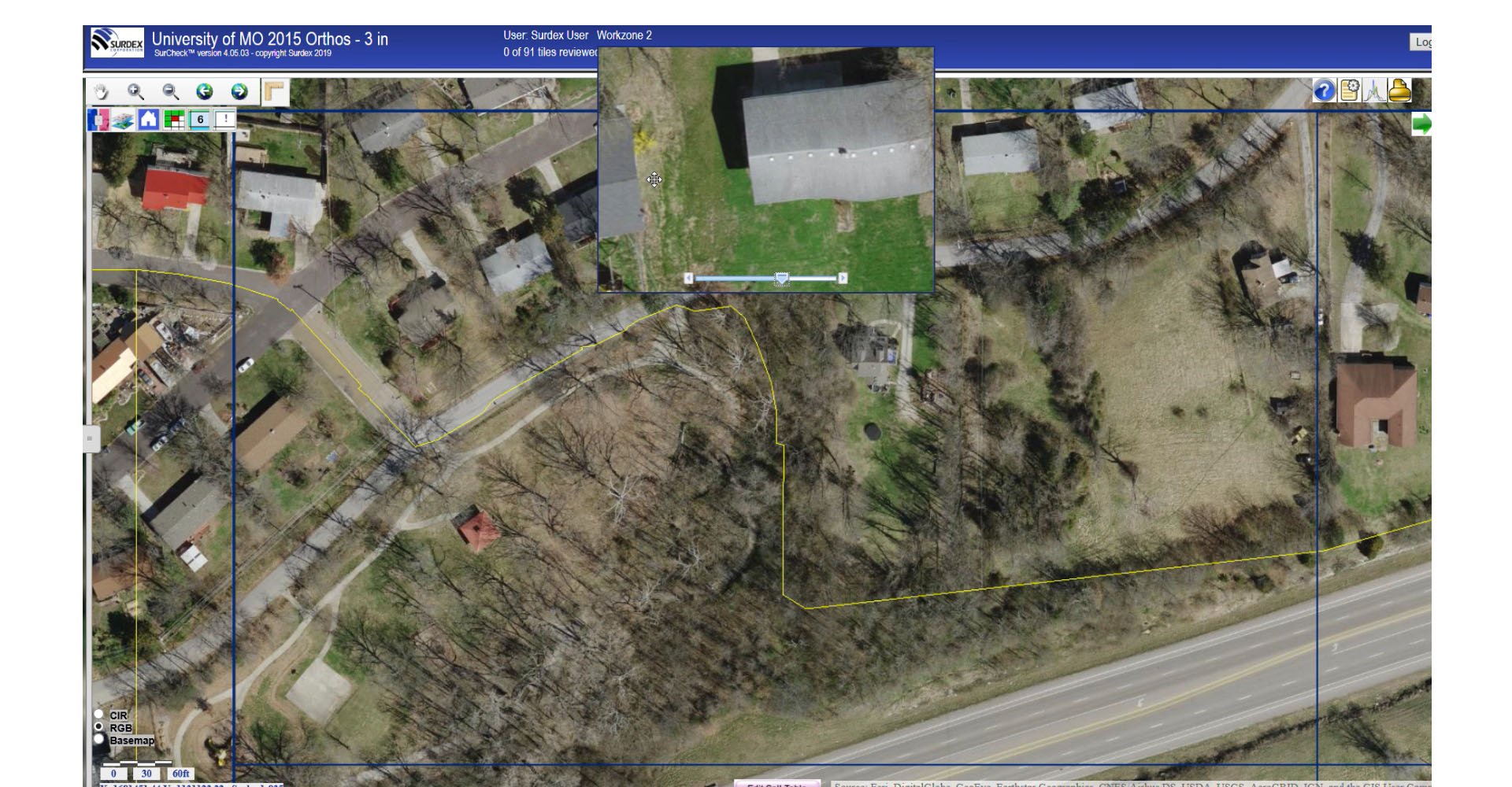
An inspector can zoom and pan around freely or use the built-in magnifier to immediately inspect areas of interest. Accepting the tile areas and clicking the arrows will automatically pull up the next tile for inspection. Accepted tiles will show up as green in the progressive inspection grid.
Making Edit Calls
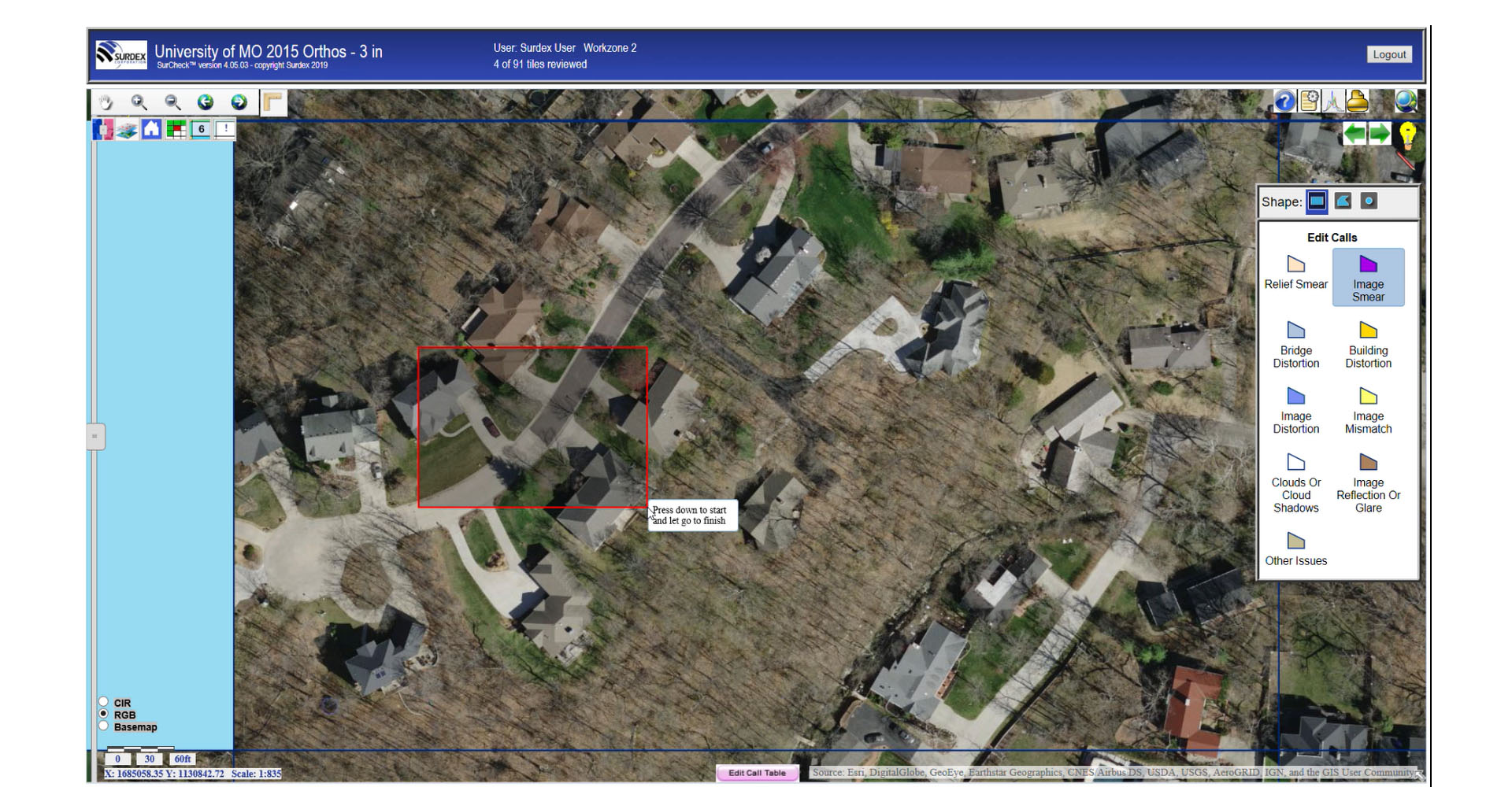
Electing the red pencil tool will display the most common types of errors and edit calls normally made, which can be applied to the tile grid.
Recording Edit Calls
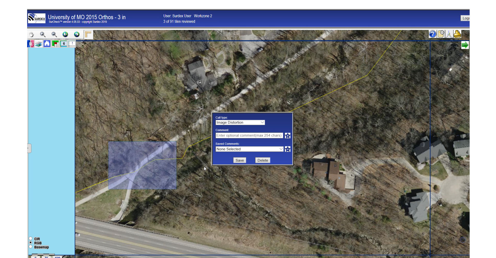
A menu will be present for an inspector to type comments to errors on the tile grid for documentation. Once comments are entered, then the tile grid will turn translucent blue indicating a comment needs inspection.
Submitting Edit Calls
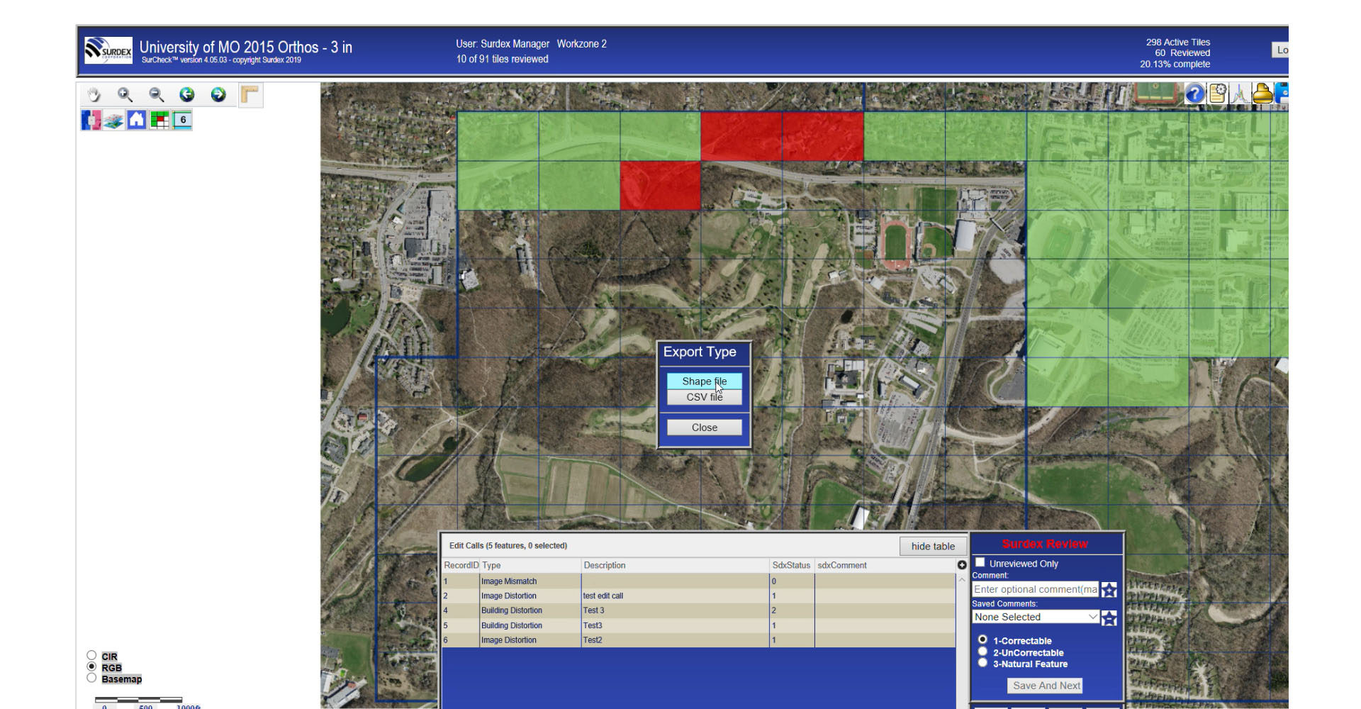
Opening up the edit call table displays all the records for edits calls on the inspection grid needing review. This creates an efficient inspection process for a manager to approve all edits on the entire grid.
Swipe Tool
Another useful tool is the swipe tool; current year imagery can be compared to another set of imagery, enabling the user to assess changes from one set of imagery to the next.