Lidar Project of Thomas Jefferson’s Monticello
Posted on
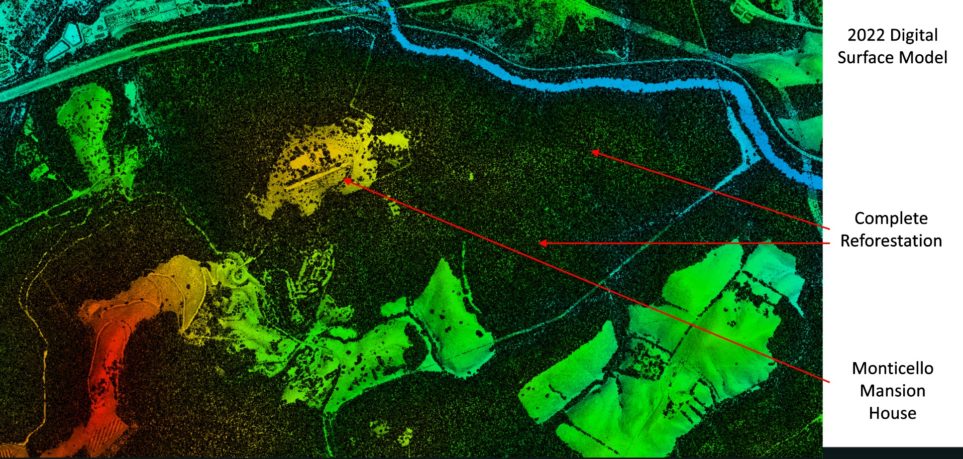
Thomas Jefferson’s Monticello plantation in Charlottesville, Virginia, was the subject of an archeological excavation that employed airborne lidar to provide archeologists with insights into the property. Aircraft equipped with precision lidar sensors obtained high-density lidar data of 33 square miles of the plantation, which revealed areas of high interest. This 30-minute podcast is hosted by Stewart Walker, Managing Editor of Lidar Magazine, and interviews Brad Barker, Director of 3D Mapping, Surdex Corporation (which conducted the aerial lidar project) and Derek Wheeler, Research Archeologist, Thomas Jefferson Foundation. The Spring issue of the magazine will feature a full article about the project with maps dating back to 1795 plus imagery from the current survey.